Drones help develop the world’s largest refugee camp
Drone research by Victoria University of Wellington is being used to improve living conditions and save lives in the Kutupalong refugee mega-camp.

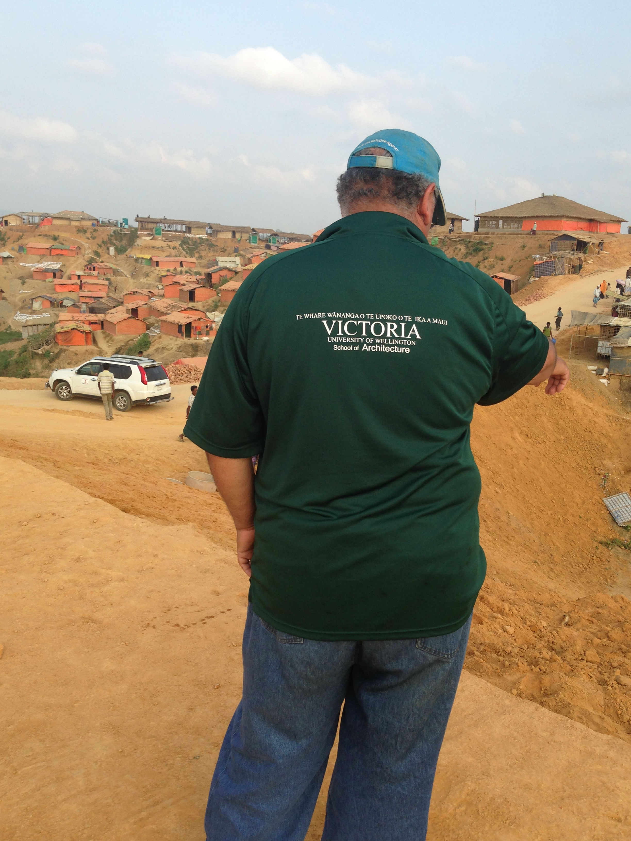
Professor Regan Potangaroa from the School of Architecture is an advocate for the role technology can play in disaster relief and humanitarian work. Since September 2017, he has been specifically researching how drone technology can improve disaster response in the Rohingya refugee camp in Bangladesh. In June this year the output of this research was put into action to help build infrastructure and relocate at-risk families.
Professor Potangaroa has created a new workflow process to rapidly produce aerial maps using drone technology.
“Creating maps with drones is complicated,” he says. “The technologies to do this exist, but previously it’s taken a long time to create a map.
“The new workflow brings together a range of drone technologies and processes so now we can put the drones up today and I can give you a map of the area tomorrow: drone today, map tomorrow. With disaster response, speed is crucial.”
Professor Potangaroa’s previous research into disaster drones is also playing an important role. These weather-resistant drones are used for assessing and surveying. The footage they record can be used by response teams on the ground to identify issues and help prioritise resources.
In Kutupalong, the world’s largest refugee camp, these drone technologies are dramatically improving the effectiveness of the work responders can do. The camp spans over 16 square kilometres and has a population of over 1.1 million. These are extremely cramped conditions for what is essentially a city, Professor Potangaroa says, and those managing it face constant challenges and extreme limitations of resources and time.
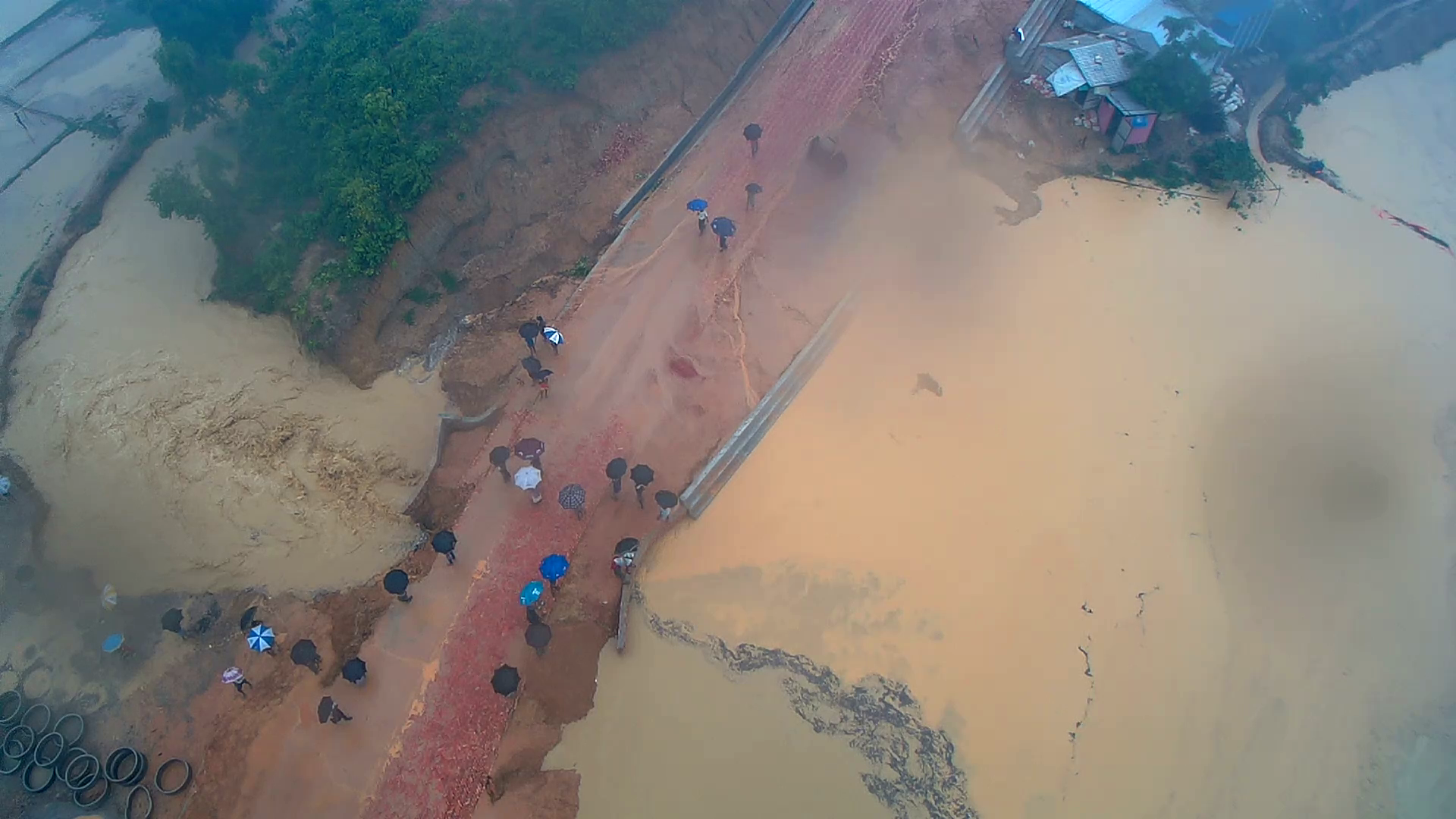
One of the biggest issues the camp is facing is the monsoon season, which can cause severe flooding and landslides.
Much of the camp was built before the monsoon rains, Professor Potangaroa says. Consequently, a lot of the infrastructure was developed without clarity on important points—such as where water would flow, where drains would be most needed and which areas of land would be most at risk.
The Bangladesh government has allocated more land for the camp to ease this congestion, which is making it possible to provide safe housing for the most vulnerable families. However, identifying those families—and finding safe locations to build them new houses—is crucial to saving their lives.
“Some families are in imminent danger, they’re not just unsafe. Their houses are at immediate risk of landslides, bank collapses, and significant flooding.”
With Professor Potangaroa’s drones, camp workers can get a rapid and accurate picture of the entire camp, especially those areas likely to be heavily impacted by the monsoons.
“For example, the disaster drones can help identify where the flooding is most critical—where road damage is more extensive and isolating people, where hospitals are cut off, whose houses are at risk of landslide. We can prioritise what needs to be done,” he says.
“You can send a drone dispatch team out to survey areas based on the information that comes in from the field workers on the ground. The drones record the situation in each location and send this back to the coordinator, who can then review the footage and decide which situations are bad, which are really bad, and which ones are impossible. Limited resources can be allocated more effectively.”
The drone mapping process is also proving crucial in identifying safe land to build new houses on, allowing families to be relocated as quickly as possible.
“Every house we can build is an average family of 4.5 people saved,” Professor Potangaroa says.
The images and maps produced are also helping with broader challenges faced by humanitarian workers in terms of health, social welfare or ‘protection’, and WASH (the supply of water and sanitation facilities).
They can also be used to promote wider awareness of the situation in the camp.
“It can be difficult for people who aren’t in humanitarian work to understand what it’s really like to be there, in Kutupalong or other response situations, and to recognise what we do. They simply don’t have a frame of reference,” Professor Potangaroa says.
“Having footage showing the extent of the disaster gets the message home about the sort of conditions people are living in and why we’re doing what we’re doing. In this sense, seeing really is believing.”